Posted by: lc1110 | May 2, 2019

An Unfamiliar Flavor of Severe Weather

A lesser-known manifestation of severe weather than tornadoes are derechos, long-lived lines of thunderstorms producing damaging winds known for rivalling tornadoes when it comes to damage done. The main reason the term derecho isn’t a household term in non-Spanish-speaking residences is because they are rare, with only a few occurring during any given year across the entirety of the US. That said, any single derecho can impact millions of people across large swaths of land. The nomenclature is derived directly from the Spanish “derecho,” meaning “straight ahead” in English to describe its motion, shown in the animation above.

Defining a Derecho:

According to the Storm Prediction Center, a thunderstorm complex must produce wind damage along a path greater than 250 miles, 58+ mph gusts along most of its length, and several widely separated 75+ mph gusts to be classified as a derecho. Although not part of the formal definition, derechos often leave other damage in their wake as a result of embedded tornadoes, torrential rain, and lightning in addition to their namesake wind damage.

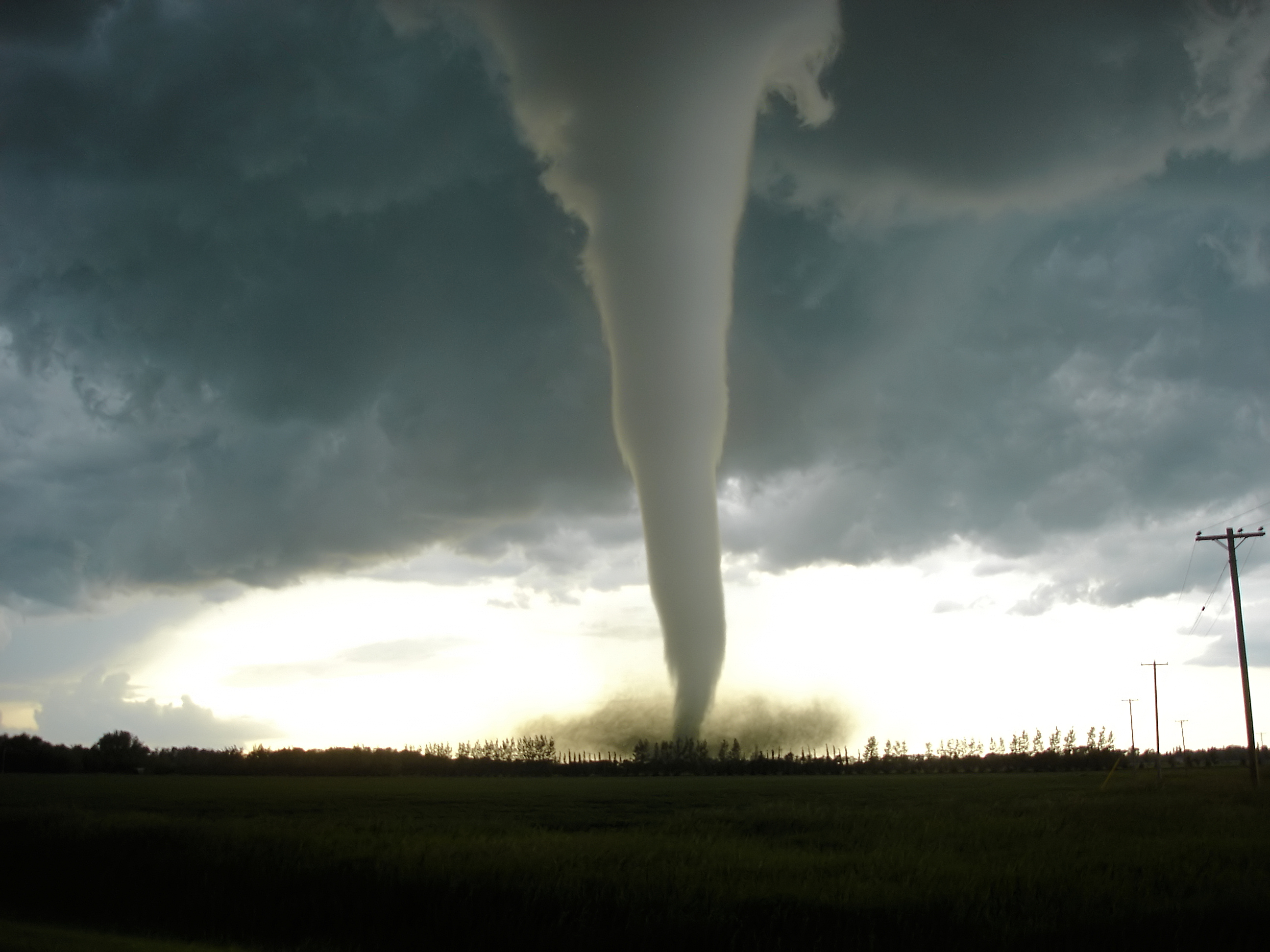
Despite these defining characteristics, derechos can be much stronger, sometimes producing wind gusts exceeding 100 mph, more than enough to cause tornado-like damage. With this in mind, an important differentiation must be made in determining the cause of thunderstorm wind damage; the damage caused by a derecho will all be oriented in the same direction, whereas a tornado will have debris thrown about in all directions.

Derecho Prone Regions:

Like with many other land-based severe weather events (i.e. tornadoes, hailstorms, blizzards, etc.), the continental US is the most prone region in the world for derechos. This is because of the unique availability to the ingredients necessary for severe weather and the flat topography of the heartland, which also offer great photo-ops for the storms. Within the continental US, the most opportune time for derechos to occur are during the months of May, June, and July, coinciding with tornado season quite nicely. With regard to location, the Corn Belt (IL, IN, OH) and the southern plains (from OK & TX northeast to the confluence of Ohio and Mississippi Rivers) are the most favored tracks for derechos to follow. That said, they do occur fairly regularly across virtually the entire eastern 2/3 of the country, even including here in NH, where the most recent documented derecho occurred in 1999 and covered in more detail here.

In Case of Derecho:

Despite the characteristic differences between tornadoes and derechos, the safety procedures are nearly identical. This means taking shelter in a sturdy building with a foundation, and getting to the lowest interior room and shelter in place until the event passes. As with tornadoes, the biggest danger with derechos is flying debris, which the walls of your house will protect you from, but not windows, which is why its not advisable to watch the storm through a window (unless being hit by flying pieces of debris and broken glass is your thing). Also, standard procedures of avoiding plumbing and electric fixtures as with any lightning storm apply, as derechos can be extremely prolific lightning-producers.

Posted by: lc1110 | April 25, 2019

Mozambique Devastation: Round 2

Just over a month has passed since my previous post regarding tropical cyclone Idai slamming into Mozambique’s coastline with unprecedented strength. Unfortunately, this is not a revisit of that storm or the situation it left central Mozambique in. Another cyclone, Kenneth, has formed and is making landfall as I write this with the equivalent strength of a category 4 hurricane (sustained winds of around 140 mph) along the northern Mozambique coast.

This is an already all-too-familiar sight, as Mozambique remains in both physical and financial stress after cyclone Idai ravaged the central coast of the country, including the city of Beira, costing Mozambique and the neighboring countries over $1B in damage. Cyclone Kenneth is stronger than Idai was at landfall, and is poised to do a similar amount of damage to a different part of the country. Perhaps some “good” news, the region of Mozambique that Kenneth is making landfall in is much less heavily populated than where Idai made landfall, so the human toll may be less devastating.

Idai made landfall in the province of Sofala, very near the major population center of Beira. As seen by the map above, Kenneth is making landfall in the less-densely populated Cabo Delgado province, a lucky break for the much denser populated Nampula province, where a landfalling cyclone would be that much more tragic.

That being said, Kenneth will still cause a major humanitarian disaster in both Cabo Delgado and Niassa provinces, as it will stall, very similarly to Idai, and dump copious amounts of rain making flooding and the dangers associated with it a real threat over the next couple days. This on top of battering the coastline with fierce winds- which very little regional architecture was built to withstand- and massive storm surge inundation. The storm surge, which is a rise in water levels due to onshore wind flow, is predicted to be anywhere between 10 to 16 feet. To put that in perspective, Hurricane Irma’s storm surge, which caused extensive damage to the SW Florida coast and the Keys in 2017, was on the order of 6-12 feet.

Final thought: Just because a disaster is slated to impact a less-populated area, doesn’t mean that it is less of a big deal. Often in developing countries such as Mozambique, less-populated areas are often less accessible for relief efforts, leading to a longer duration issue. To put it another way, the smaller percentage of the population impacted will take a bigger toll. I believe this impact will be enhanced in this situation given the continued struggle to aid those devastated by Idai just a few short weeks ago.

Posted by: lc1110 | April 20, 2019

Tornado Preparedness: Dos and Don’ts

Seeing that tornado season is quickly ramping up with outbreaks occurring on a weekly basis as of late, it is beneficial to go over some common misconceptions bout tornadoes and tornado safety. Some of these misconceptions are not only time-wasters, but can end up putting your life or property in greater peril than it otherwise would be.

Don’t: Seek Shelter in a Car.

Although a car offers effective protection against another dangerous severe weather threat, lightning, it offers very little in the way of shelter in the path of a tornado. This is because tornadoes are very often strong enough to lift cars and toss them around, endangering anyone inside. People will often think they can outrun a tornado if they hop in their car and gun it on the interstate. This is a dangerous game to play seeing that the path of a tornado is often unpredictable, as is its speed, making it difficult to outrun even for trained professionals.

Do: Seek Shelter in a Sturdy Building.

Unlike a car, a building is anchored to the ground and will likely have a basement or interior room that will serve as better protection against the dangers of a tornado, if a designated underground tornado shelter is unavailable. Also, most safe buildings will have plumbing that will serve just as well as a car’s metal frame against a possible lightning strike.

Don’t: Seek Shelter Under an Overpass.

Another popular misconception is that an overpass will protect you and/or your car from wind-driven debris. This is incorrect, as winds are accelerated due to the tunneling effect underneath the overpass, making it more likely for anything under it- people, cars, other objects- to become flying debris- not exactly a safe scenario.

Do: Be Prepared Before Severe Weather Hits.

This includes having a shelter-in-place plan at both your work and home, an emergency kit with medical supplies, non-perishable food, important documents, et cetera (a more complete list can be found here). Having a pre-prepared kit and emergency plan will save valuable time if a tornado is imminent.

Do: Practice Situational Awareness.

Albeit easier said than done, being cognizant of what’s going on around you (not just weather-wise) can help you to avoid dangerous situations in the first place, or at the very least minimizing the amount of surprise they strike with. Practicing situational awareness can be as simple as paying attention to the skies- if you see menacing clouds, utilize modern technology and ensure there aren’t any watches or warnings issued for your area. The National Weather Service plays a vital role in saving lives in dangerous weather, constantly trying to improve warning time and minimize deaths in tornadic activity. That said, situational awareness can reduce the need to rely on warning time- if you can see, hear, or feel storms approaching, be proactive and prepare instead of waiting for the NWS to chime in.

Posted by: lc1110 | April 11, 2019

Monster Storm in Great Plains


If you’ve been keeping up with the news lately, you know that the blizzard occurring in the northern Plains states is the second intense storm to strike the region this spring, and that it is packing all kinds of inclement weather in the nation’s midsection. From 2’+ of snow in Minnesota, to hail and tornadoes in the Mississippi Valley and dangerous winds in NM and TX, this storm is a harsh reminder that spring is a transition season.

First, some more detail about why this storm is significant. To begin, it is intense, as its central pressure (an important indicator of the strength of weather systems) is very low – 988mb – for a low so far inland. Also, as mentioned before, its variety of weather conditions- a hallmark of springtime systems- is expansive, with heavy snow, high winds, severe thunderstorms, and critical fire danger all a direct result of the storm dubbed “Wesley” by The Weather Channel. These impacts are not lacking in magnitude either, as winds will be gusting to near 60 mph in a region from the Texas-New Mexico border to Northern Minnesota and Wisconsin.

I have mentioned that the transition seasons- namely spring- is known for producing intense storms with a slew of impacts, and there is a reason for this. Simply put, all the ingredients for intensification of large-scale weather systems are present in the spring. The first- and most prominent- of these is a strong temperature gradient, which develops as a result of warm air expanding northward in response to the increasing sun angle, which encounters stubborn cold air from the winter thus setting up a “battle zone” between warm and cold air masses. Because of this tight temperature gradient, the jet stream is stronger, and thus more favorable for supporting the development of these storms in the upper levels. Coupled with increasing moisture flow out of the Gulf of Mexico, springtime can certainly deliver storms on par with this one regularly.

The impacts of this storm have already claimed the life of one in Colorado, and resulted in injuries to several others. All casualties thus far have been related to unsafe travel conditions causing crashes. Despite this storm still wreaking havoc, there is the threat for more similarly intense storms to develop in this region in the coming weeks, albeit with less of a wintry side and more intense severe weather. Regardless, those experiencing the impacts of these spring storms, whatever they might be, should heed warnings and take precautions to avoid loss of life and property.

Posted by: lc1110 | April 4, 2019

‘Fire Season’ in New England

Just this morning, the weather forecast offices in New England posted Red Flag Warnings for all of southern New England, extending into southern NH and westward into the NYC region. In a region not known for massive wildfires (such as those in the western US), this may come as a surprise to some. A common question is “We don’t have a dry season here, so how could we have such a high fire danger right now with all the snow melt?” The answer to this question lies in two places: the trees and the recent weather.

Normally, if the rivers are running high (as they currently are), we will have had recent precipitation, and therefore moist soil and minimal fire threat. Presently, the snow pack has been eliminated in the southern half of the region, and the ground has had a chance to dry out, despite occasional rain showers in the past weeks. These rain showers would be sufficient to keep the soil moist and fire threat low in the summer, but now in early spring, before the trees have developed their foliage, the strong April Sun is able to dry out the soil- even in heavily wooded areas- very quickly, setting the stage for elevated fire danger.

Because there is a period of time between those of snow pack and foliage twice per year (New England’s “fire seasons” – early spring and late fall), the right weather conditions can trigger fire weather headlines from the National Weather Service (NWS), as has occurred today. These atmospheric conditions- gusty winds, low humidity, and mild temperatures- combined with the present soil conditions make for a difficult fire to control, if any were to ignite. The importance of tree foliage is that it both increases ambient humidity and shades a vast area of ground from direct sunlight, maintaining its moisture even in times of moderate drought.

Final thoughts: Just because us New Englanders don’t usually have to worry about wildfires consuming whole towns and charring millions of acres of forest, it is still crucial to take heed of the warnings when they are posted and not be reckless with potential sources of ignition like cigarettes and bonfires. If a person haphazardly starts a wildfire in these conditions, they are not only legally responsible, they must then deal with the moral situation of putting others’ property and safety in jeopardy. Just like any watch, warning, or advisory issued by the NWS, they are put out for a reason (to protect life, limb, and property), and the information they contain should be taken seriously.

Posted by: lc1110 | March 28, 2019

A Universal Recipe for Hurricanes

Last week’s post promised a more detailed explanation of what hurricanes need to form, which answers the question of why they are less common in the southern hemisphere than in the northern hemisphere. First, the ingredients, the availability of most can either limit or enhance the frequency and/or intensity of the storms:

A tropical disturbance: Usually in the form of a tropical wave (just think a weak, disorganized low pressure system) in the Atlantic Basin, elsewhere the disturbance is a remnant region of lower pressure from thunderstorm activity. This is one of the ingredients that is essential to the formation of hurricanes, as these are essentially the seeds from which the storms grow. The reason it is crucial is that, without it, there is no focusing mechanism for the thunderstorms to grow.

Deep convection: Convection is just a fancy meteorological term for thunderstorms, and the ‘deep’ part incites that the thunderstorms are tall, and therefore intense. This early formation ingredient is most beneficial when it is at the center of circulation of the disturbance, as it provides the upward motion that is analogous to the electric starter for an engine; it gets the circulation going at all levels of the atmosphere. A hurricane can still form if the convection isn’t over the center, yet these storms are frequently weaker and take longer to form.

Warm ocean water: Much like the fuel to an engine, this provides the energy for the storm to intensify. This warm water destabilizes the air above it (see post on tornado ingredients for instability explanation), allowing the convection to happen and perpetuate. It is a self-feeding system, as the storm’s intensification expands its surface wind field, thus increasing the rate at which the air gains energy from the water, and intensifying the convection further, and so on. The storm cannot pull this sort of energy out of land, which is why they all weaken when they then make landfall- the fuel source is cut off.

Minimal wind shear: Opposite to tornadoes, hurricanes need a low-shear environment to develop, since the existence of wind shear effectively decapitates the convection and displaces it from the storm’s center, which we now know inhibits the storm’s development.

Time: The last essential ingredient, time is necessary for these storms to form, even in the midst of perfect conditions. Continuing the analogy to an engine, even when warm and brand new, an engine will still turn over a couple times before roaring to life. The same principle applies for hurricanes, which need these ingredients present to some degree for a couple days before the storm’s ‘engine’ can get going.

Above is an image denoting the regions where hurricanes (and the varying regional nomenclature for them) form. From this, one can see that the area in the northern hemisphere where they form is more expansive. This is because the tropical North Atlantic, East and West Pacific basins all have availability of all the ingredients in the recipe to some extent or another every warm season. More telling in the Southern Hemisphere is the location and number of arrows instead of the orange shading- these areas are not nearly as prolific at producing cyclones as the graphic might advertise. This is because these areas are usually lacking in either tropical disturbances, low wind shear, and time- the location of land masses typically disallows any disturbance the time necessary to develop into a cyclone.

Finally, the connection to last week’s post. The main reason why the Mozambique cyclone was so devastating was because it had taken an unusually long time to make landfall- it had stalled in an area of favorable conditions and weak steering currents, allowing it to intensify to anomalous levels before finally making landfall.

Posted by: lc1110 | March 21, 2019

Thoughts on Devastating Mozambique Cyclone

T.C. Idai seen rotating clockwise (opposite to those of the Northern Hemisphere) making landfall in Mozambique. Source: https://upload.wikimedia.org/

The countries of Mozambique, Zimbabwe, and Malawi were met with fearsome destruction after an “intense tropical cyclone” (known as a major hurricane in the Atlantic Basin) made landfall last Friday in Beira, Mozambique. Above is a satellite image of the cyclone, named Idai, as it made landfall directly over the coastal city of Beira, which experienced a major storm surge, as well as 120mph sustained winds (Category 3 equivalent) that combined for unanticipated destruction. Thereafter, Idai proceeded inland in the direction of Zimbabwe and Malawi, where it stalled out (stopped moving) and dumped copious amounts of rain in the area, leading to extreme flooding (shown below). The latest confirmed death toll from all three countries is 504, a number nearly certain to rise as recovery slowly continues. With thousands of people still unaccounted for in Mozambique, this already tragic death toll might just double or even triple.

So what are the reasons why this storm was so disastrous?

The answers lie in the area’s storm history, economic status, and general preparedness (or lack thereof). First, this area does not see very many cyclones, as the ingredients necessary are not as available as they are in the tropical North Atlantic and Pacific oceans (more on that next week). Those that do hit, usually are fairly weak, which makes Idai a stark anomaly. This sparse history of cyclones in the region as well as being a very undeveloped part of the world in terms of insignificant infrastructure and emergency response capabilities, can also be blamed for the severity of the disaster. These factors force people to hunker down in their homes (which are, for the most part, not built to withstand these conditions), as they lack the physical and financial means to safely evacuate. This unfortunately leads to the astronomical death tolls being seen now.

Also impacted by the rampant poverty in this region of the world is how people receive warnings about impending weather, as well as what things people can do to prepare in advance. Most people here are unable to procure the items necessary in a storm-readiness kit, much less know when a storm is imminent. This means that, unfortunately, a storm of this magnitude striking this area would cause mass casualties, as has occurred this past weekend.

Final thoughts: as major a tragedy as this is, a bigger tragedy would be to not take it as a lesson in hurricane preparedness, especially in a developed nation such as the US, where everyone has the means to evacuate safely from the dangers of the storm, and the infrastructure to support such a mass movement of people exists. People died in this storm because they had no option but to stay put and try to ride it out- there is no excuse for those in the US to put themselves (along with loved ones and first responders) in danger by doing the same. It is both frustrating and insulting to emergency officials and the meteorologists who predict these storms when people knowingly stay behind and endanger themselves despite ample warning. Therefore, any death in the US caused by people not evacuating and electing to ride out a hurricane is inexcusable.


Posted by: lc1110 | March 7, 2019

The Ingredients Necessary for Tornado Formation

This past Sunday saw a major tornado outbreak in the Deep South, with the most devastation coming from one in particular, which was rated an EF-4 and carved a path through east-central Alabama. According to preliminary NWS data, the tornado caused 23 deaths and nearly 100 injuries, not to mention catastrophic damage to homes and infrastructure. Unfortunately, violent tornadoes such as these are a harsh reality for the southeast quadrant of the contiguous US, especially in the spring. To understand why they are so common in the spring, we must first understand what ingredients are necessary for tornadoes to form.

The first three ingredients are necessary for any severe thunderstorms to take place. They are lift, instability, and moisture. Lift is any atmospheric mechanism that forces air at or near the surface to rise- this can be a front, a low pressure system, or upslope winds on mountain ranges. In the case of these tornadoes, a low pressure system drove a strong warm front across the region, which provided more than enough lift for thunderstorms to form.

The next ingredient is instability. In layman’s terms, it is the tendency for air to rise once it is forced up in the atmosphere. For air to be unstable, meaning the air at lower levels wants to rise up through the atmosphere, it needs to be less dense at the lower levels then above it. Warm, moist air at the surface and cold air aloft provided for a very unstable environment on Sunday, also contributing to the formation of the severe thunderstorms.

Moisture is the third ingredient, and the most basic to understand. You can’t really have thunderstorms without some influx of moist air (which also ties into the instability factor, as moist air is less dense than dry air), which we saw in the south on Sunday, courtesy of a southerly wind off the Gulf of Mexico, a major source of atmospheric moisture for the entire eastern half of the country.

The final ingredient, and the most crucial for tornado formation, is wind shear. Simply put, it is how the wind changes as you go up in the atmosphere- it can get stronger and change direction (as shown in the graphic). High levels of wind shear, both directional and speed, are necessary for strong tornadoes to form, as was the case Sunday. To understand how this causes tornados to form, simply hold a pencil between the palms of your hands, turned horizontally. Move the top hand faster than the other; the pencil will roll, similar to what happens in the atmosphere under these conditions. Thunderstorms can then take this horizontal rotation and turn it vertical, and eventually spin up a tornado.

Final thought: with spring nearing, this promises to be only the beginning of more devastation in the coming months, as these conditions will be present numerous times this season (perhaps as early as this coming weekend). This is why it is essential for those in tornado-prone areas to know what to do when faced with the sort of scenario that impacted the Deep South this past weekend, and be prepared to do so. Information on how to prepare is available here.

Posted by: lc1110 | March 1, 2019

An Insight into This Week’s Windstorm

This past week saw quite the windstorm unfold over the northeastern quadrant of the contiguous US, stretching from Minnesota to Kentucky to Maine. Most places affected saw wind gusts topping 50 mph, more than enough to cause scattered power outages, with some reaching 60 mph. These gusty northwesterly winds are not all that uncommon in the wintertime, as blizzards do form and produce this kind of destructive wind patterns. That said, most areas didn’t experience a prototypical blizzard, with the exception of Wisconsin and Minnesota.

So if this wasn’t a blizzard, then how did it get so windy?

First, we must have an idea of what causes the wind. Generally speaking, it is the flow of air from regions of high pressure to regions of low pressure, and the closer (and stronger) the regions are to one another, the stronger the pressure gradient between them. It is this pressure gradient that results in a force enacted on the air in and near the systems, called the pressure gradient force (PGF). For all intents and purposes, it is this force that drives the wind we feel at the surface.

To visualize the PGF on a map, one must look at a plot of sea level pressure (above) and look for the strongest gradients that don’t involve mountainous regions (the Rocky Mountains always seem to have a really strong pressure gradient, this is because elevation causes problems with this parameter), denoted by bunches of isobars (lines between colors here) packed really close together. This can be seen over Minnesota and Wisconsin, stretching into the Ohio Valley.

This area of strong PGF moved eastward, impacting much of the northeast and New England, causing strong wind gusts in the area, some topping 60 mph. This pales in comparison to the peak wind observation atop Mount Washington, a place prone to extreme wind, where they measured a gust to 171 mph on Monday. This was the highest recorded wind speed in their history in the month of February. For perspective, the highest wind gust measured at the summit was during a storm in 1934, where they measured 231 mph. So yes, they are used to crazy wind up there at 6,288 feet.

Posted by: lc1110 | February 21, 2019

2018-19 – New England’s Stubborn Snowfall Pattern


If there was one word to sum up this winter for snow-lovers in southern New England, “disheartening” would just about do it. There has been an unusually stubborn storm track this winter, which has caused a gap in snowfall in most of southern New England for most of this winter, whereas areas north and west of central NH have seen copious amounts of the stuff since it began accumulating in November. The graphic above illustrates this contrast nicely.

Granted, it is perfectly normal for the higher elevations of northern New England to receive more snowfall than those in the southern half of the region, however, the gradient this year along the I-93 corridor (extending N-S through central NH down to Boston, MA) is unusually large. Some locations in the mountains of western ME are approaching record high seasonal snowfall totals, whereas Boston, MA is experiencing a top-10 lowest seasonal snowfall on record to this point. That is to say, above-average snowfall is occurring adjacent to anomalously low snowfall, and with no shortage of precipitation anywhere, this has all to do with the flavor of storms we have seen this winter.

In short, the major storm track this winter has been west of New England, with the systems moving through the eastern Great Lakes. When this happens, New England is on the warm side of the system, with southeasterly winds bringing in warmer air into the region. That said, the mountains in northern New England impede the progress of the warm air through a process called cold-air damming (illustrated below). The influence of this process- and where it keeps cold air deep enough for snow to fall- is confined mainly to VT, NH, and ME. This leaves most of MA, and all of RI and CT exposed to the infiltration of warmer marine air, which causes a changeover to rain in these areas.

Apart from this type of storm focusing snowfall in northern New England, the lack of a storm tracking nearby offshore- which historically produces most of southern New England’s snowfall- has just as much to do with this snowfall discrepancy. It is the lack of a typical Nor’Easter that has resulted in the below-average snowfall in these areas, as the above average snowfall in the north is attributed to the inland storms.

While the time left for this deficit to be corrected is waning, the good news about this discrepancy is in that the ski resorts are having a great season in the north, and the major population centers in the south have been spared some major impacts they would otherwise have had to deal with. Time will tell whether this trend continues and if it turns out saving southern New England in road maintenance costs.

A final thought: I’m hesitant to blame climate change for this winter’s character, as the stubborn storm track seems to be purely coincidental, and that places in the mid-Atlantic states have seen a few significant snowstorms this season so far. The ingredients have been there (cold air, a disturbance in both jet streams, and moisture), but they have just not produced a classic Nor’Easter yet this winter. Perhaps this is in repayment for last winter, when they were exceedingly plentiful, especially in late February and March.

Older Posts »

Categories